

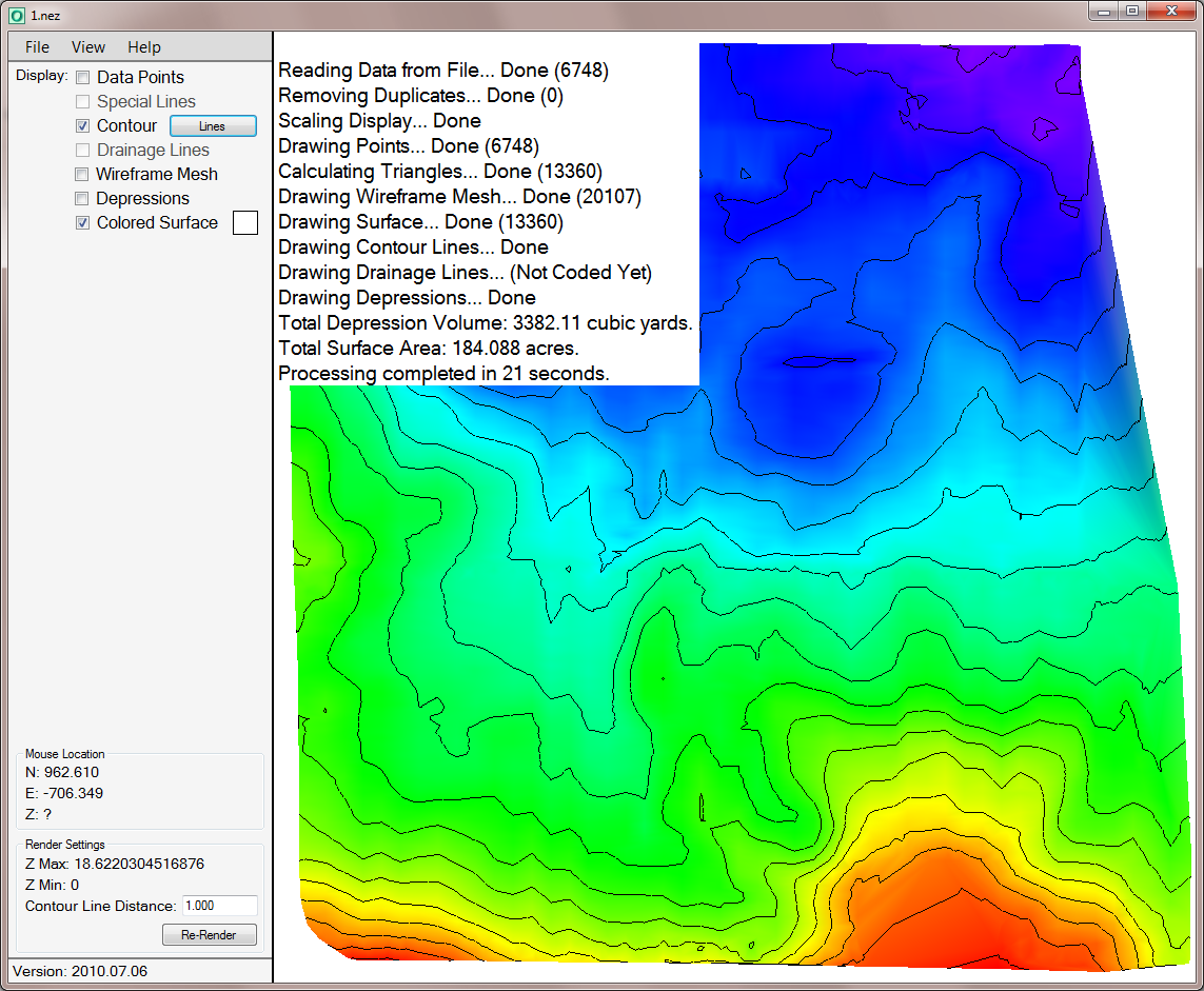
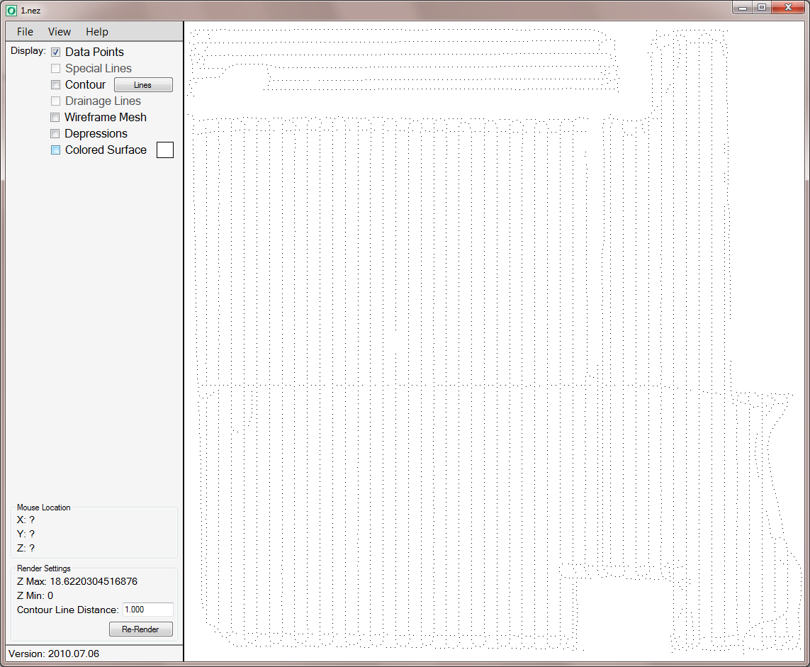
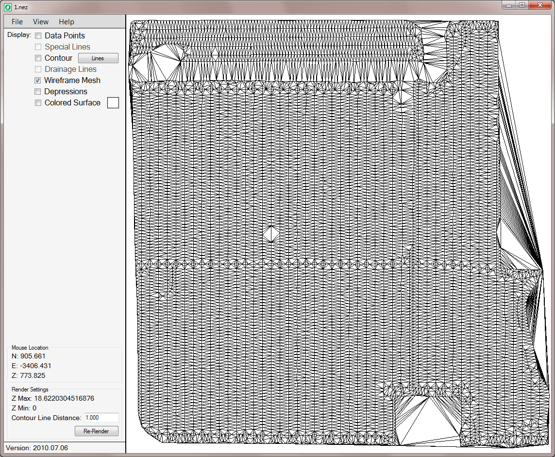
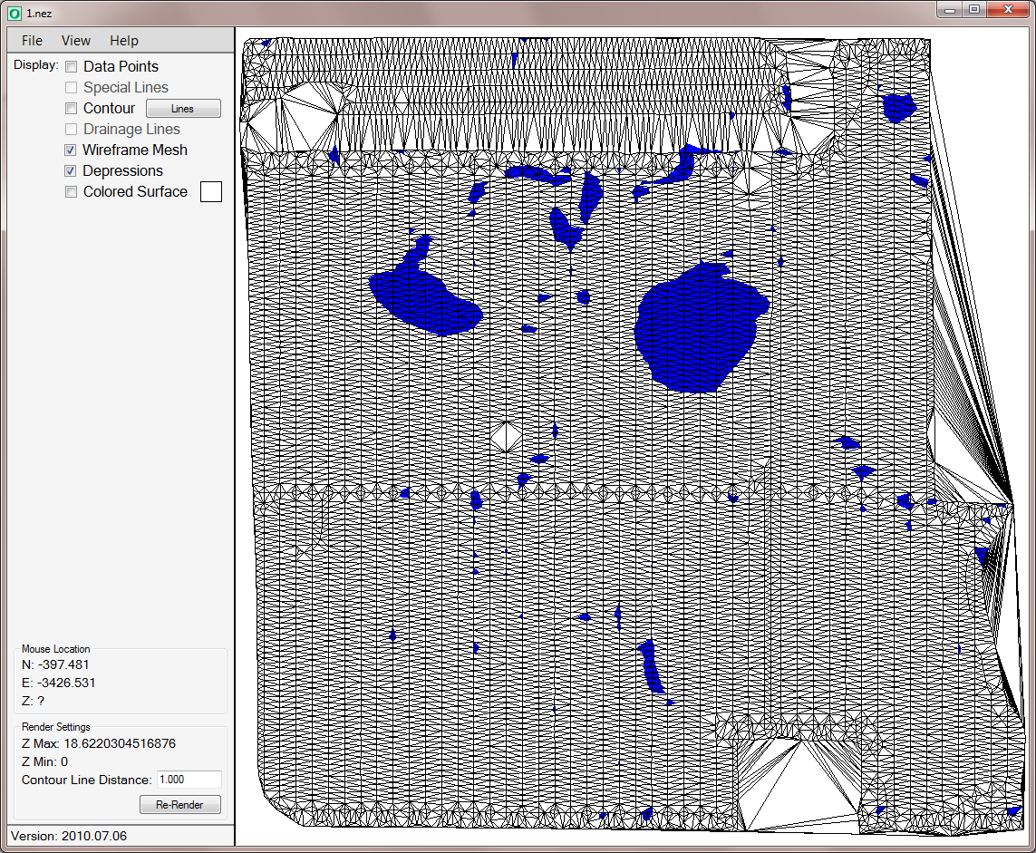
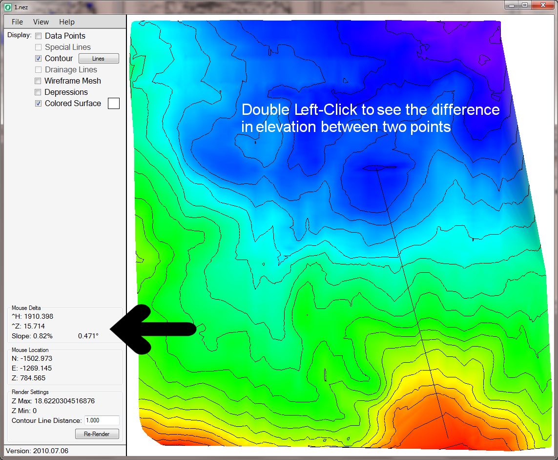
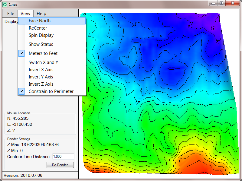
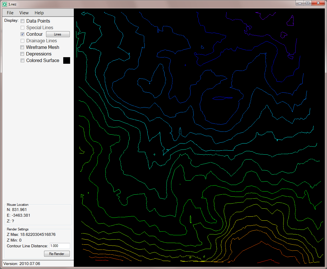
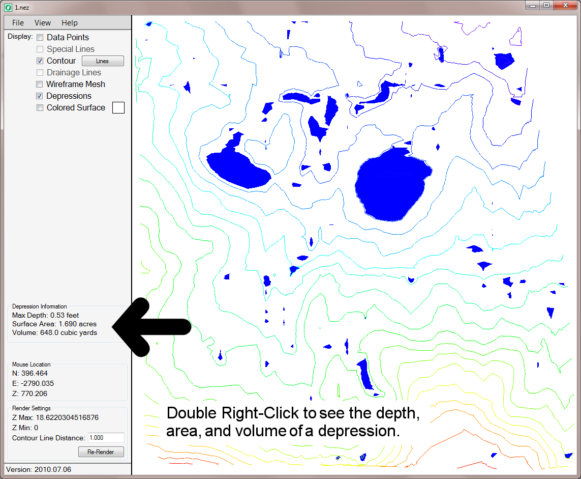
Elevation Office is an easy way to visualize the surface data from .NEZ files. The data points are converted to a triangulated wireframe mesh, color is added by elevation, contour lines drawn at a specified interval, and depressions are located and shaded. The data is rendered in a 3d environment, so you can zoom in or out, rotate, and pan the data to see the places you are most interested in, and turn on just the layers you want to see. You can save an image of the map, along with a geo-referenced world file to use as a background image in other programs. You can also measure the horizontal and vertical difference between two points, and the slope is calculated for you. You can check the depth, surface area, and volume of any depressions.
- Microsoft Windows 2000 or newer
- Microsoft .Net framework v2.0 or higher
- Microsoft Direct X
$500 US
30 day demo available upon request. E-mail Lance@Lefebure.com for more information.